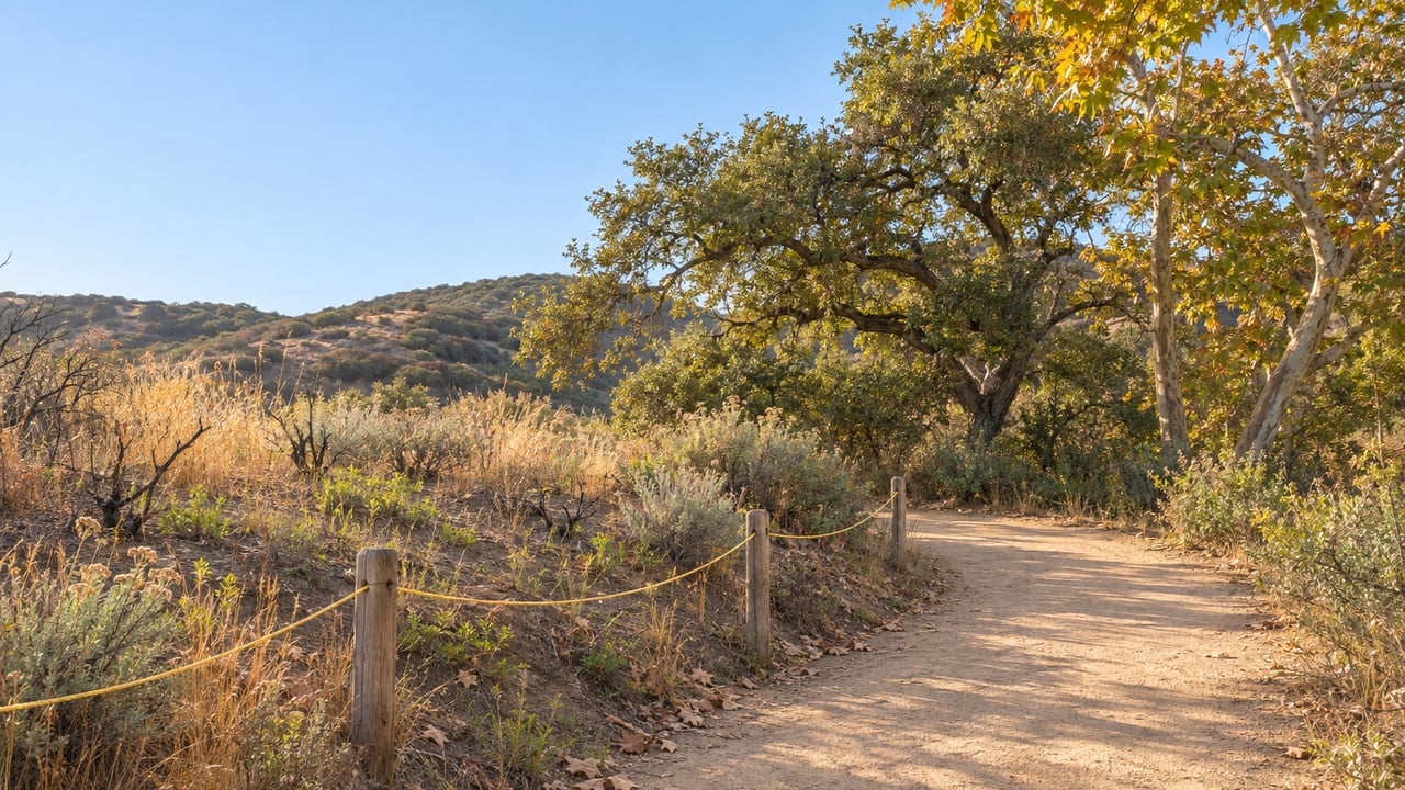
Past the Waterfall, the walk west through Los Peñasquitos Canyon Preserve now runs between lines of yellow rope. On both sides you see blackened ground. Some of the old landmarks are missing, and in places the tracks of fire crews and their machines cross the old path. Every authorized trail in the preserve has been open since Oct. 2, after weeks of closure, but this section is a different walk now.
The rope is what most changes this part of the canyon. It shows you where the trail actually is. Rangers say it protects ground that is easy to damage right now, and they plan to leave it in place until the plants have grown back. Rangers say that could take months or years, and this winter is the burned ground's first rainy season.
Where the two fires burned
Two fires hit the west end of the preserve this year. A June fire burned about 90 acres, OutdoorSoCal reported. On Aug. 16, the Sorrento Fire started near Sorrento Valley Boulevard and Carmel Mountain Road and burned through the same stretch of canyon. CAL FIRE's incident page puts the Sorrento Fire at 138 acres. In a Sept. 13 update posted by the Friends of Los Peñasquitos Canyon Preserve, Park Ranger Melanie Fontana said the two burn scars together cover more than 230 acres. The burned trails include the North Main and South Main trails, Sidehill, Big Waimea and Little Waimea.
Date | What happened |
|---|---|
June 2026 | A fire burns roughly 90 acres in the preserve's west end |
Aug. 16, 3:15 p.m. | The Sorrento Fire starts near Sorrento Valley Boulevard and Carmel Mountain Road |
Sept. 1, 9:47 p.m. | CAL FIRE lists the Sorrento Fire as contained |
Sept. 13 | Everything from the Waterfall west to Vista Sorrento Parkway is still closed |
Oct. 2 | All authorized trails reopen, with yellow rope through the burn scar |
The closure stayed in place after the flames were out because of the trees. Fontana explained that many adult trees were girdled by the fire and many young ones burned completely. Fire weakens a tree's structure and makes it likely to drop limbs or fall over. San Diego Fire-Rescue firefighters cut the dangerous trees in between engine and paramedic calls. Rangers, partner groups and volunteers had already put up several thousand feet of fencing along the South Main and North Main trails by mid-September.
The rope shows you where the trail is
Fontana's Sept. 13 update says the barrier marks the authorized route and protects the ground on each side of it:
"It is temporary fencing, but on an ecological timescale. Once in place, we will only remove it when the habitat has suitably grown-in, rendering the fencing unnecessary. That can be anywhere from months to years depending on the habitat."
She also lays out why stepping off the trail matters more now than before the fire. The fire left a thin, ashy crust on the ground that helps keep wind and rain from carrying the soil away. Footsteps break that crust and turn the soil and ash into dust, and slopes erode fastest. People also carry nonnative seeds into burned areas on their shoes. Fontana wrote that this can let invasive plants replace the native ones, and she called that change the biggest threat to the region's biodiversity.
Some of the canyon is already coming back. In the Oct. 2 reopening notice, Senior Park Ranger Gina Washington said rangers were seeing more animal activity throughout the west end. She also warned that some trails would close now and then while San Diego Fire-Rescue crews keep working on the access roads. Those closures are meant to be temporary and limited to specific areas.
Why this first rainy season matters
The burned ground now faces its first rainy season. Fontana raised concern about higher rain predictions tied to El Niño years and said soil disturbed after a fire washes downstream as well as away from the burn scar itself.
Even before the fires, the preserve had a firm wet-weather rule. The City of San Diego's visitor page says trails close during rain and for at least 48 hours afterward because of flooding and unsafe conditions. The County of San Diego's park notices page also lists the preserve's staging area among places that often close during and after storms. It says closures can last from hours to days depending on how much rain falls. This winter, keeping off a muddy trail does more than protect your shoes. It also protects ground that is trying to regrow.
For current trail status, the City sends visitors to the Park Ranger Office at 858-538-8066. Call before you go, especially after a storm or when you plan to head west of the Waterfall.
Getting to the Waterfall from the Peñasquitos side
The burned area lies west of the Waterfall, toward Sorrento Valley. You can still start from the Rancho Peñasquitos side and reach the edge of the recovery zone. Three entrances serve this side of the canyon:
- East staging area: at Black Mountain Road and Mercy Road. The County lists the preserve address as 12020 Black Mountain Road and says this lot allows vehicle and equestrian parking.
- Adobe ranch house: the historic ranch house sits at the east end, off Black Mountain Road on Canyonside Park Driveway.
- Park Village Road: the northern entrance, near Peñasquitos Creek Park at Park Village Road and Camino Del Sur. The City calls the 1.3-mile hike from the end of Park Village Road the shortest, easiest way to reach the Waterfall. It takes about 20 to 30 minutes.
The usual rules still apply, and some of them matter more next to a burn scar. Dogs must stay on a leash no longer than 8 feet. Bikes may ride only on designated trails, at no more than 10 mph. Parking lots are closed from sunset until 8 a.m.
Riders already know one group working on the canyon. The San Diego Mountain Biking Association runs a volunteer Trail Ambassador program at PQ, as many people call the preserve. It also paid for the 2024 rebuild of the Sycamore Crossing, which was built to survive the seasonal flooding that had damaged it again and again. After the August fire, OutdoorSoCal reported that SDMBA got approval from the ranger team to start a community recovery coalition of trail users, neighbors and local businesses.
Dates to put on the calendar before the new year
Rangers have turned recovery into regular volunteer work, and anyone who uses the canyon can join in. These are the scheduled dates from now into February:
- Saturday, Nov. 28, 7:45 to 10 a.m.: "Birding with all your senses with Jeanie Anderson," a Friends of Los Peñasquitos Canyon Preserve walk that meets at the west end of the Canyonside Park driveway trailhead.
- Saturday, Dec. 12, 9 a.m. to noon: the City's Waterfall Rehabilitation Project, held on the second Saturday of each month on the North Main Trail at the Waterfall. Volunteers water native prairie and pollinator plants, pull invasive species and expand the restoration site a little at a time, working with Ranger Haley and Senior Ranger Gina. The next sessions are Jan. 9 and Feb. 13, 2027.
- Sundays, Nov. 29, Dec. 13 and Dec. 27, 2 to 4 p.m.: Friends-led restoration volunteering for Black Mountain Open Space Park, starting from Black Mountain Ranch Community Park at 14700 Carmel Valley Road.
The work aimed most directly at the fire is the City's Burn Scar Recovery Squad. Volunteers work with ranger staff on the June and August burn scars. They put up protective fencing and signs, install erosion controls, remove invasive plants and litter, and spread native seed. The project repeats, but not on a regular schedule. Outside summer, sessions run from 9 a.m. to noon. Meeting spots rotate among the Vereda Sol Del Dios, Gablewood and Manorgate trailheads and the West Staging Area off Sorrento Valley Boulevard. The City asks volunteers to email the rangers at [email protected] to confirm dates and locations. Bring sturdy closed-toe shoes, work gloves, water and something to cover your face, because the site is in full sun and the wind kicks up dust and ash. Rain or excessive heat can cancel a session.
Most of the preserve is managed by the City of San Diego. Other sections belong to the County of San Diego and the California Department of Fish and Wildlife. Rangers have said the yellow rope comes down once the plants have grown in. The more people stay inside it this winter, the sooner that happens.
We keep up with the canyon the way our Peñasquitos neighbors do. If you're wondering how being close to the preserve affects what your home is worth, Abundant Path Homes can give you a straight answer with no pressure. Start with a free home valuation, or read more about Rancho Peñasquitos on our neighborhood page.